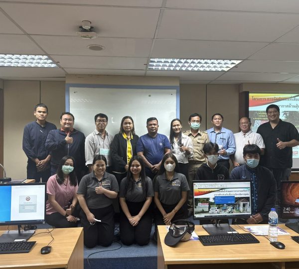
21 August 2023, Phitsanulok – NU SECRA collaborated with various organizations to initiate a project aimed at transferring technology to non-governmental and local organizations in Phitsanulok and Phichit provinces. This project is called “Risk Map for Flood and Air Pollution Dispersion for Community Management” and is hosted at the Information Technology and Communication Services Center, Naresuan University.
Assoc. Prof. Dr. Korakod Nusit, the Director of Research Excellence in Energy and Environmental Technology, reported that the project’s objective is to disseminate and enhance skills and knowledge in utilizing geographic information system (GIS) for mapping flood hazards and other disasters. This is intended for personnel from governmental agencies, local administrative organizations, and community development NGOs, allowing them to be better prepared for disasters and integrate these skills into their missions.
Assoc. Prof. Dr. Sarintip Tantanee, Acting President of Naresuan University, and NU SECRA Project Lead, welcomed and emphasized the need for data-driven and technology-driven work in the present era. Universities such as Naresuan University can play a pivotal role in collaborating with communities to apply knowledge and skills for effective planning and prediction related to various potential disasters or emergencies.
Dr. Bhichit Rattakul, Chairman of the Thai Network for Disaster Resilience (TNDR), provided an opening statement on the topic of “The Role of Geographic Information Systems in Enhancing Disaster Resilience in Thailand.” He highlighted the challenges in disaster preparedness and management due to the lack of awareness regarding available data and tools. He stressed the importance of making data accessible and understandable to communities and promoting community-driven solutions.
The “Risk Map for Flood and Air Pollution Dispersion for Community Management” Project involved approximately 20 participants from local administrative organizations, community development NGOs, Naresuan University faculty and students, and other interested parties in Phitsanulok and Phichit provinces. The project lasted for one day and was made possible through the collaboration of various entities, including the Northern Science Park, Research Excellence in Energy and Environmental Technology, Northern Lower GIS (GIS NU), the Faculty of Engineering at Naresuan University, the SECRA project, and the FOUNTAIN project, both supported by the ERASMUS+ program of the European Union, as well as the Thai Network for Disaster Resilience (TNDR).
![]()


